Fort Lauderdale sits on a narrow strip of land east of the Intracoastal Waterway, which means a large portion of the city falls inside Broward County's first mandatory evacuation tier. When a storm approaches, residents here have less time and less room for error than drivers in most other Florida cities. The decisions made in the first hours - which zone you're in, which route to take, how full the tank is, what to do if water covers the road - determine whether you clear the area safely or become part of the problem slowing everyone behind you. This guide covers the specific rules, zones, and driving realities that apply to Fort Lauderdale and Broward County, not generic hurricane advice.
Broward County's Two-Plan System: How Fort Lauderdale's Evacuation Zones Actually Work
If you've looked up hurricane evacuation zones in other Florida counties, you've seen letters: Zone A, Zone B, Zone C, and so on. Broward County uses a different system entirely, and drivers who move here from elsewhere in Florida or read statewide evacuation guides can easily be confused by the difference.
Broward operates two unnamed plans - Plan A and Plan B. There are no lettered zones, no color-coded sub-districts. The dividing lines are geographic boundaries, and either a mandatory order applies to your address or it does not. Plan A is typically ordered for Category 1 or Category 2 storms. Plan B is ordered for Category 3 storms and stronger, when the threat expands significantly inland.
This matters practically because many Fort Lauderdale residents, accustomed to hearing "Zone A evacuees must leave" in statewide coverage, don't immediately recognize that Broward's "Plan A" is its own separate geographic system. When Broward Emergency Management issues a Plan A order, it covers specific physical boundaries - not a lettered designation. Knowing which plan applies to your address, and verifying that at broward.org/hurricane before any storm forms, is the starting point for everything else.
| Factor | Plan A | Plan B |
|---|---|---|
| Typical storm trigger | Category 1-2 | Category 3 and stronger |
| Mobile home residents | Must evacuate | Must evacuate |
| East of Intracoastal Waterway | Must evacuate | Must evacuate |
| East of US-1 (Federal Highway) | Not included | Must evacuate |
| Additional cities pulled in | Fort Lauderdale beach-side neighborhoods | Inland Hollywood, Pompano Beach sections added |

Who Has to Leave: What Plan A and Plan B Cover, and Which Fort Lauderdale Neighborhoods Fall Inside Each
Plan A requires evacuation of three groups: all mobile home residents in Broward County regardless of location, all residents beside tidal water or in low-lying flood areas, and every resident east of the Intracoastal Waterway. That last boundary puts a significant portion of Fort Lauderdale squarely inside the mandatory zone for even a moderate storm.
Specific Fort Lauderdale neighborhoods that sit east of the Intracoastal and fall under Plan A include Las Olas Isles, Coral Ridge, Harbor Beach, and Rio Vista. These are not obscure or marginal areas - they include some of the city's most established residential streets. If you live, work, or are caring for someone in those neighborhoods, Plan A applies when it is ordered.
Plan B expands the mandatory boundary west to US-1, also known as Federal Highway. When a strong storm is forecast, everyone east of Federal Highway must evacuate - pulling in additional sections of Fort Lauderdale, Hollywood, and Pompano Beach that would not be covered under Plan A alone. The area between the Intracoastal and Federal Highway is densely developed, and the volume of people required to leave simultaneously under a Plan B order is substantially larger than under Plan A.
- Mobile home residents anywhere in Broward County fall under Plan A - location away from the coast does not exempt a mobile home park from the mandatory order
- A concrete high-rise east of the Intracoastal does not exempt residents from Plan A; the boundary is geographic and based on storm surge risk, not building construction
- If you stayed safely through a Plan A storm, do not assume Plan B carries the same risk level - the added area between the Intracoastal and US-1 is densely populated and pushes significantly more vehicles onto every outbound corridor simultaneously
- Verify your specific address at broward.org/hurricane; neighborhood names do not always align with official plan boundaries, and the address lookup is the only reliable check
Florida Law on Mandatory Evacuation Orders: What the Statute Says and What Enforcement Looks Like in Practice
Florida law makes it a criminal offense to refuse a mandatory evacuation order. The relevant section of Florida Statutes classifies the violation as a second-degree misdemeanor, carrying potential penalties that include jail time and fines - check the current Florida Statutes or the Florida Division of Emergency Management website for the specific penalties in force, as those figures are subject to legislative change. The obligation applies once a local emergency management official or the governor issues a mandatory order for your area.
In practice, law enforcement during an evacuation focuses on moving traffic outbound, not on arresting residents who refuse to leave. Officers are directing traffic, keeping routes clear, and responding to accidents - not conducting door-to-door compliance checks. Enforcement of the refusal provision is rare. But the practical consequences of staying are severe regardless of legal risk: once conditions deteriorate, rescue resources become unavailable or unsafe to deploy, and you take full responsibility for your own situation in a structure that may not survive storm surge or wind loading.
The law also matters for a second reason. Once a mandatory order is issued and you remain, you are legally on notice that emergency services may not reach you. Florida emergency management doctrine makes clear that rescue priority shifts dramatically once evacuation windows close. The order carries legal weight - not just a strong suggestion - and the timeline it implies is real.

Emergency Shoulder Use: What Florida's ESU System Is, How It Works, and What Drivers Need to Know
Florida replaced traditional contraflow lane reversal - where highway lanes are switched to run in the opposite direction - with a system called Emergency Shoulder Use, or ESU. Under ESU, paved highway shoulders temporarily become travel lanes to add outbound capacity without the complexity and risk of reversing traffic flow.
ESU was first activated during Hurricane Irma in September 2017 on northbound I-75, running for approximately 39 hours. FDOT activated it again for Hurricane Ian in 2022 and for Hurricane Milton in October 2024. Each activation is authorized by FDOT and announced publicly through Florida 511 and emergency management channels. Do not assume a shoulder is open because traffic is heavy - wait for official activation before entering.
Which Shoulder Opens and Who Can Use It
On four-lane highways, the right (outside) shoulder opens under ESU. On six-lane highways, the left (inside) shoulder opens. This distinction matters because the behavior of traffic around you changes depending on which shoulder is active, and merging into the wrong area creates hazards for everyone nearby.
Large trucks, buses, and trailers are prohibited from ESU lanes regardless of how bad traffic is. Those vehicles are too wide to safely navigate the shoulder. Passenger cars and standard personal vehicles may use the lane when it is officially open.
ESU shoulder lanes are noticeably narrower than standard travel lanes. FDOT specifically warns drivers to reduce speed and watch for storm drains, gutters, and drainage inlets embedded in the surface. The shoulder also narrows at bridges, overpasses, and guardrail sections.
Tolls During Evacuation: How Suspension Works and What It Means for SunPass and Toll-by-Plate Users
Only the Florida Governor has authority to suspend tolls statewide. Governor Scott suspended all tolls statewide ahead of Hurricane Irma in 2017. Governor DeSantis did the same for Hurricane Milton in October 2024, with the suspension beginning several days before landfall. When suspension is in effect, it covers all toll facilities - SunPass transponders are not charged, and Toll-by-Plate billing does not generate a notice for travel during the suspension window.
Suspension is announced through Florida 511, local news, and official emergency management channels. Do not assume tolls are suspended because traffic is heavy or because a storm is approaching - the governor must formally issue the order. If you drive through a toll plaza without paying and no suspension has been declared, normal collection and enforcement processes apply.
For departure planning, the practical upside of toll suspension is that it removes the need to carry cash or worry about your SunPass balance. The downside is that it happens only after a formal declaration, which may not be in place during the earliest voluntary departure window. Leaving early - before orders become mandatory - is nearly always the right call, even if it means paying tolls normally. That cost is trivial compared to the time saved by leaving before traffic locks the causeways.
Before Hurricane Season Starts: The Half-Full Rule and Vehicle Prep Every Fort Lauderdale Driver Needs
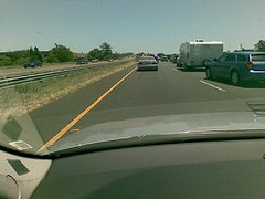
Keep your tank at least half full throughout hurricane season so you can leave the moment an order is issued - without waiting in fuel lines that may not move fast enough.Florida Disaster 'Halfway Full, Halfway There' campaign
Florida Disaster's campaign distills one core habit: maintain at least a half-full tank throughout the entire hurricane season, which runs June 1 through November 30. Gas stations in South Florida empty within hours of an evacuation order. Residents who keep their tanks topped up can leave immediately or at minimum top off quickly before conditions worsen.
Stations well north of the storm's projected cone typically remain open and stocked. The sound strategy is to stop at a station north of the cone during your trip, not at a local Fort Lauderdale station before you leave. Stations near the coast will be crowded, may run out of regular fuel, and the time spent waiting in those lines is time you cannot recover.
Fuel Storage and the Cabin Rule
Extra gas cans stored at home are useful for topping off before departure. One rule that has no exceptions: never place fuel cans inside a vehicle's passenger cabin. Gasoline fumes escape containers even when sealed, and inside a closed vehicle those fumes create fire hazard and carbon monoxide risk. Fuel cans belong in an open truck bed or secured external cargo area - not in the back seat or enclosed cargo area of an SUV or sedan.
Electric Vehicles
Fort Lauderdale has significant EV ownership, and EV drivers need a different pre-season routine. Florida emergency management officials advise keeping the battery charge between roughly half and near-full capacity throughout hurricane season rather than running it low and charging only when convenient. Before any storm is forecast, identify public charging stations along your planned evacuation route. Once an order drops, chargers along major outbound corridors can be occupied or offline. Having that route and those waypoints mapped in advance removes one decision from a day that will already be full of them.
Evacuation Day: When to Leave, Which Routes to Take Out of Broward, and What to Pack in the Car
The most important driving decision during a hurricane evacuation is leaving during the voluntary window if your situation allows it. Voluntary evacuation windows exist because traffic is lighter, fuel is available, and roads are still passable. By the time a Plan A mandatory order is formally issued for Fort Lauderdale beach neighborhoods, some residents will already be sitting in grid-locked traffic on the causeway bridges trying to cross the Intracoastal.
Broward County's Primary Evacuation Corridors
- I-595 West connects to I-75 (Alligator Alley), offering a path across the state toward Naples or north toward Orlando - I-75 is one of the highways where ESU has been activated in past storms
- US-27 runs north through the western edge of Broward County, providing an alternative corridor away from the coast for residents who can reach it
- Florida 511 and Broward Emergency Management provide real-time corridor guidance and closure information - monitor these before and during departure
Florida FLHSMV specifically advises carrying printed paper maps during evacuations. Cell service becomes unreliable as storm traffic and network congestion grow, and GPS navigation on a phone can fail at the exact moment you need to decide which ramp to take. Print Florida and regional maps before hurricane season, not on evacuation day.
What to Have in the Car Before You Pull Out of the Driveway
- Printed maps showing every east-west crossing of the Intracoastal available to you - Fort Lauderdale's bridge points are limited, and a single closure during evacuation shifts a large volume of traffic onto whichever crossings remain open
- Photographs or brief video of your home's contents taken before you leave, along with copies of your flood and homeowner's insurance documents - properties in Plan A areas carry elevated storm surge risk, and documentation started before a storm is far easier than recreating it afterward
- Enough cash for multiple fuel stops north of the projected cone and at least one overnight stay, since ATMs at popular evacuation destinations are frequently depleted by the time the first wave of evacuees arrives
- Identification, prescription medications for the full estimated absence, and any medical device supplies for each person in the vehicle
- Vaccination records for any pets and a confirmed destination that accepts animals - Florida emergency shelters and pet-friendly lodging along outbound corridors routinely require documentation at intake
Flooded Roads During and After the Storm: Turn Around, Don't Drown
National Weather Service 'Turn Around, Don't Drown' data shows more than half of all flood-related drownings occur in vehicles. Drivers consistently underestimate how little moving water is needed to push a car off the road or prevent it from stopping.
Moving water that barely covers the road surface can carry away most standard passenger cars. Fast-moving water that looks manageable from inside an SUV or pickup can displace those vehicles as well - the current acts on the full surface area of the underside, not just the tires, and the vehicle can be swept into deeper water before the driver fully registers what is happening. These situations develop in seconds, not minutes.
The rule is absolute: if water is moving across a road and you cannot see the pavement surface clearly, do not drive through it. Turn around, even if that means backtracking a significant distance. Find an alternate route using your paper map. If no alternate exists, stop at the highest nearby ground and wait. Do not drive around barriers - those barriers mark flood depths that have already been confirmed dangerous by people who measured them.
This applies after the storm as well. Floodwaters recede slowly, and roads that were covered during the storm can remain impassable for hours or days afterward. Returning too early is one of the most common causes of post-storm vehicle losses in South Florida, and the roads closest to the Intracoastal and tidal areas are the last to drain.
If You Break Down During Evacuation: Where to Pull Over, Who to Call, and What to Do on an ESU Shoulder
A breakdown during an evacuation is dangerous because other drivers are moving fast, stressed, and focused on getting out - not watching carefully for stopped vehicles. Getting clear of moving traffic is the first and only priority.
- Activate your hazard lights immediately, even before the vehicle is fully stopped.
- Move as far right as safely possible. If ESU is active and the right shoulder is a travel lane, do not stop on it - proceed to the nearest off-ramp or emergency pull-off area.
- Stay inside the vehicle with doors locked if you are in or adjacent to a travel lane. Do not stand behind the car on or near the roadway.
- Call Florida 511 for road condition and assistance information, or Florida Highway Patrol's non-emergency line if you need law enforcement help.
- If you must exit the vehicle for immediate safety, move to the right side of the guardrail, away from all traffic, and stay low.
- Do not attempt roadside repairs in a travel lane or on an active ESU shoulder. Wait for professional assistance to reach you.
Do not try to flag down other evacuation traffic for help. Lanes are moving, other drivers are under pressure, and a person standing in evacuation traffic is in serious danger. Make the vehicle visible with hazard lights and yourself safe until help arrives. A delayed departure from a breakdown is far better than a second incident caused by trying to manage it in an active travel lane.
Frequently Asked Questions
Does Plan A apply to me if I live in a high-rise east of the Intracoastal?
Yes. If your address falls east of the Intracoastal Waterway, Broward's Plan A mandatory order applies regardless of building type or construction quality. Modern concrete high-rises can withstand wind better than older wood-frame structures, but mandatory orders are based on geographic flood risk and storm surge projections, not building materials. Only the county can issue building-specific exceptions during a named storm event.
Can large pickup trucks or camper vans use ESU shoulder lanes?
Large trucks, buses, and trailers are explicitly prohibited from ESU lanes. Whether a specific pickup truck or camper van falls under that prohibition depends on its classification and size - when ESU is activated, FDOT publishes vehicle eligibility guidance for that specific event. If your vehicle is significantly larger than a standard passenger car, treat the ESU shoulder as off-limits and follow posted signage at the point of entry.